
![]()
![]() Please return to the previous page and try again
Please return to the previous page and try again
Regional geochemical atlases
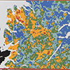
Regional geochemical atlases provide a systematic picture of the geochemistry of the whole of Britain. The principal aims of this atlas series are to identify new sources of metalliferous minerals, and to provide quantitative information on natural element levels which may be used to assess contamination. In the first seven volumes, published from 1978 onwards, the account of the regional geochemistry is based on the point-source data plotted on geological maps at a scale of 1:250 000. Subsequent volumes are in a new format and based on digital geochemical imagery.
 Shetland: regional geochemical atlas
 Orkney: regional geochemical atlas
 South Orkney and Caithness: regional geochemical atlas
 Sutherland: regional geochemical atlas
 Hebrides: regional geochemical atlas
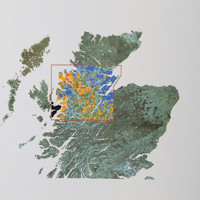 Great Glen: regional geochemical atlas
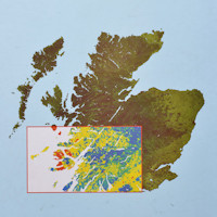 Argyll: regional geochemical atlas
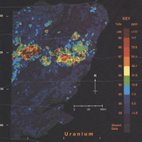 Regional geochemistry of the East Grampian area
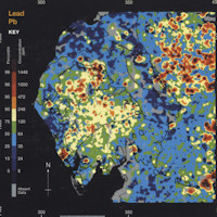 Regional geochemistry of the Lake District and adjacent areas
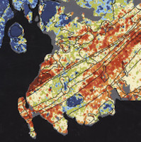 Regional geochemistry of Southern Scotland and part of northern England
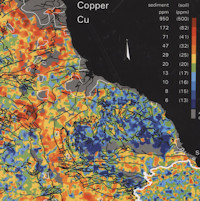 Regional geochemistry of north-east England
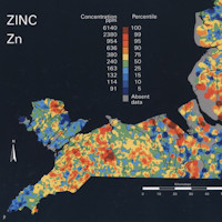 Regional geochemistry of North-west England and North Waless
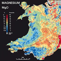 Regional geochemistry of Wales and part of west-central England: Stream sediment and soil
Geocemeg rhanbarthol Cymru a rahn o orllwin-canolbarth Lloegr: gwaddod nant a phridd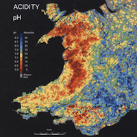 Regional geochemistry of Wales and part of west-central England: streamwater
Geocemeg rhanbarthol Cymru a rhan o orllewin-canolbarth Lloegr: dwr nant
-
Regional geochemical atlases provide a systematic picture of the geochemistry of the whole of Britain. The principal aims of this atlas series are to identify new sources of metalliferous minerals, and to provide quantitative information on natural element levels which may be used to assess contamination. In the first seven volumes, published from 1978 onwards, the account of the regional geochemistry is based on the point-source data plotted on geological maps at a scale of 1:250 000. Subsequent volumes are in a new format and based on digital geochemical imagery.
Purchase this altas in the BGS Online Bookshop