
![]()
![]() Loading map series page 1
Loading map series page 1
Geological Survey of Ireland longitudinal sections, old series
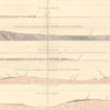
A set of four horizontal sections across the whole of Ireland. They cover a distance of one hundred and thirty miles and had been surveyed on the ground by Henry De la Beche, Thomas Oldham and Warrington W. Smyth. Maps were issued in 1848.
1848 – 1848Various scalesEire (Ireland)
Return maps per page