This resource provides high resolution scans of almost all small and medium scale maps produced by the British Geological Survey since mapping started in 1832. It includes the key 1:63 360/1:50 000 maps of England and Wales and of Scotland. For users who just want to consult the latest editions of the 1:63 360/1:50 000 maps 'Quick links' have been provided below.
Please be aware that the maps, sections and atlases delivered by this portal are scanned copies of the most recently published and printed maps produced by BGS. Professional users are advised that our most recent mapping is now only updated and delivered digitally without production of a printed product. Our latest digital mapping is available via our Onshore and Offshore GeoIndex pages, and may differ significantly from the older versions delivered via this portal.
While viewing the map images is free, paper copies of maps that are still in print are also available for purchase through the BGS online shop. For out of print maps BGS offer a 'Print-on-Demand' service.
Solid geology, Quaternary geology and sea-bed sediment maps of the UK and continental shelf. The series started in 1977 and superseded the 'Quarter-inch' maps of England and Wales and of Scotland.
Illustrate small departures from the expected values of the earth's magnetic field caused by the variations in the magnetisation of the rocks within the earth's crust. Maps were issued 1977–1990.
Illustrate small departures from the expected values of the earth's gravity caused by the variations in the density of the rocks within the earth's crust. Maps were issued 1975–1989.
A small number of Free-air anomaly maps were produced. They are the measured gravity anomaly after a free-air correction is applied to correct for the elevation at which a measurement is made compared with Sea Level. Maps were issued 1981–1989.
These maps cover aspects of groundwater availability, exploitation and quality and were published between 1967 and 1994 at various scales from 1:50 000 to 1:625 000.
The regional geochemical atlases are the principal hard copy product of the British Geological Survey G-BASE project. The majority of atlases are for stream sediments; with data on stream waters and soils included when available. Separate stream sediment/soil and stream water atlases have been published for Wales. Maps were issued 1978–2000.
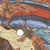
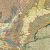
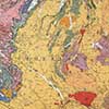
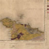
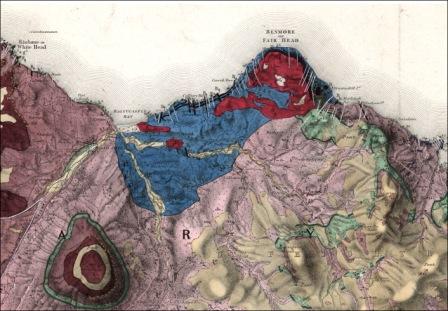
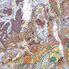
The main Geological Survey map series from 1835 to about 1900. Earlier sheets issued as full sheets, later sheets in quarter sheet form. All hand-coloured.
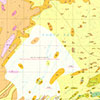
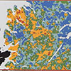
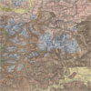
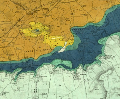
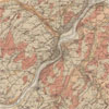
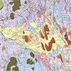
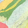
The most recently published medium scale map series for England and Wales in 360 sheet areas. Editions as Bedrock (formerly Solid); Superficial Deposits (formerly Drift); Bedrock and Superficial Deposits (formerly Solid & Drift). Earlier sheets one inch to one mile, later at 1:50 000. Maps were issued 1856–2013.
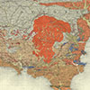
A set of hand coloured-quarter inch to the mile maps covering England and Wales, published between 1889 and 1895 with later revisions. They were engraved on copper. A very popular series at the time.
Following the popularity of the Old Series 'Quarter-inch' map a New Series of colour-printed 'Quarter-inch' maps was issued. A long-lived series with sheets still published in the later 1970s. Maps were issued 1906–1977.
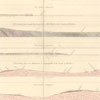
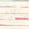
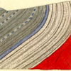
Horizontal sections were the first attempt by the Survey to indicate 'the arrangement of rocks beneath the surface'. Undertaken on the scale of six inches to the mile they were issued with a small explanatory pamphlet. Maps were issued 1844–1894.
Vertical sections were drawn to illustrate the succession of strata in the coalfields. They were usually drawn on a vertical scale of 40 feet to one inch. Maps were issued 1850–1949.
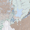
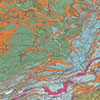
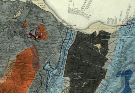
The main Geological Survey map series from 1865 to the present day. Early maps were hand coloured and from c. 1900 colour printed. Coverage in 131 sheet areas but with the scale change to 1:50 000 sheet areas were split into East and West sheets.
A series of colour-printed 'Quarter-inch' maps, first published well after the corresponding English series in 1907. The series was long-lived, being eventually superseded in the 1970–1980s by the 1:250 000 UTM series. Maps were issued 1904–1977.
The main Geological Survey map series for Ireland. There were 205 map sheets in the series, and many sheets were issued in more than one edition. Sheets were issued in Solid or Solid with Drift editions. Maps were issued 1853–1963.
A small number of Drift sheets were published during the period, mostly around the main cities, Dublin, Cork, Limerick, Belfast and Londonderry. Maps were issued 1902–1922.
A set of four horizontal sections across the whole of Ireland. They cover a distance of one hundred and thirty miles and had been surveyed on the ground by Henry De la Beche, Thomas Oldham and Warrington W. Smyth. Maps were issued in 1848.
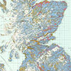
These maps offer whole-country coverage of the United Kingdom. Geological, tectonic, structural, mineral resources and geophysical maps are represented together with a small number of historical facsimile maps.
Solid geology, Quaternary geology and sea-bed sediment maps of the UK and continental shelf. The series started in 1977 and superseded the 'Quarter-inch' maps of England and Wales and of Scotland.
The main Geological Survey map series from 1835 to about 1900. Earlier sheets issued as full sheets, later sheets in quarter sheet form. All hand-coloured.
The most recently published medium scale map series for England and Wales in 360 sheet areas. Editions as Bedrock (formerly Solid); Superficial Deposits (formerly Drift); Bedrock and Superficial Deposits (formerly Solid & Drift). Earlier sheets one inch to one mile, later at 1:50 000. Maps were issued 1856–2013.
A set of hand coloured-quarter inch to the mile maps covering England and Wales, published between 1889 and 1895 with later revisions. They were engraved on copper. A very popular series at the time.
Following the popularity of the Old Series 'Quarter-inch' map a New Series of colour-printed 'Quarter-inch' maps was issued. A long-lived series with sheets still published in the later 1970s. Maps were issued 1906–1977.
The main Geological Survey map series from 1865 to the present day. Early maps were hand coloured and from c. 1900 colour printed. Coverage in 131 sheet areas but with the scale change to 1:50 000 sheet areas were split into East and West sheets.
A series of colour-printed 'Quarter-inch' maps, first published well after the corresponding English series in 1907. The series was long-lived, being eventually superseded in the 1970–1980s by the 1:250 000 UTM series. Maps were issued 1904–1977.
The main Geological Survey map series for Ireland. There were 205 map sheets in the series, and many sheets were issued in more than one edition. Sheets were issued in Solid or Solid with Drift editions. Maps were issued 1853–1963.
A small number of Drift sheets were published during the period, mostly around the main cities, Dublin, Cork, Limerick, Belfast and Londonderry. Maps were issued 1902–1922.
Horizontal sections were the first attempt by the Survey to indicate 'the arrangement of rocks beneath the surface'. Undertaken on the scale of six inches to the mile they were issued with a small explanatory pamphlet. Maps were issued 1844–1894.
Vertical sections were drawn to illustrate the succession of strata in the coalfields. They were usually drawn on a vertical scale of 40 feet to one inch. Maps were issued 1850–1949.
A set of four horizontal sections across the whole of Ireland. They cover a distance of one hundred and thirty miles and had been surveyed on the ground by Henry De la Beche, Thomas Oldham and Warrington W. Smyth. Maps were issued in 1848.
Illustrate small departures from the expected values of the earth's magnetic field caused by the variations in the magnetisation of the rocks within the earth's crust. Maps were issued 1977–1990.
Illustrate small departures from the expected values of the earth's gravity caused by the variations in the density of the rocks within the earth's crust. Maps were issued 1975–1989.
A small number of Free-air anomaly maps were produced. They are the measured gravity anomaly after a free-air correction is applied to correct for the elevation at which a measurement is made compared with Sea Level. Maps were issued 1981–1989.
The regional geochemical atlases are the principal hard copy product of the British Geological Survey G-BASE project. The majority of atlases are for stream sediments; with data on stream waters and soils included when available. Separate stream sediment/soil and stream water atlases have been published for Wales. Maps were issued 1978–2000.
These maps cover aspects of groundwater availability, exploitation and quality and were published between 1967 and 1994 at various scales from 1:50 000 to 1:625 000.
These maps offer whole-country coverage of the United Kingdom. Geological, tectonic, structural, mineral resources and geophysical maps are represented together with a small number of historical facsimile maps.
An insight into the origin and early practice of systematic geological mapping by the Geological Survey; the application of hand-colouring; why the constant need for revision?


 Geological Survey of England and Wales, New Series 1:63 360/1:50 000 geological map series
 Geological Survey of Scotland 1:63 360/1:50 000 geological map series