The origins of systematic geological mapping in Britain
Henry Thomas De la Beche (1796–1855) was perhaps the first person to geologically survey an entire Ordnance Survey one-inch topographical map sheet.
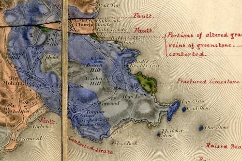
His first completed sheet (Old Series 22) was undertaken at his own expense in 1830–31 and covered south-east Devon and part of Dorset, including Lyme Regis where he was then living.
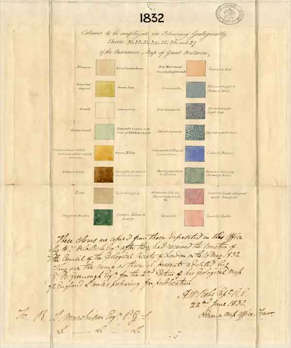
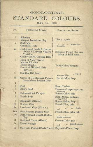
In May 1832 De la Beche succeeded in obtaining financial support from the Board of Ordnance to undertake a geological survey of Devonshire. One stipulation was that he should consult with the Geological Society to come up with an agreed scheme of colours.
The resulting table of 16 formations (right) soon became inadequate as more rock units were identified during the course of mapping. Today the BGS recognises some 2500 formations — see the BGS Lexicon of Named Rock Units.
Founding of the Geological Survey
With the support of the Geological Society, De la Beche next succeeded in establishing the Geological Survey on a formal basis, on 11 July 1835, as a department within the Ordnance Survey.
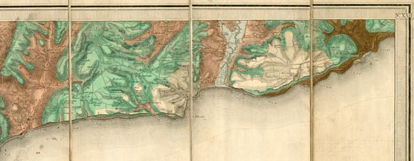
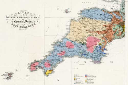
Mapping progressed into Cornwall, and by 1837 the whole of South West England had been geologically surveyed.
Preservation of field maps and fossils
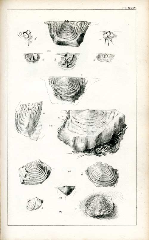
The Devonian Controversy of 1834–39 involved a dispute over the application of fossil evidence to stratigraphic interpretation. The dispute threatened to undermine the authority of the Geological Survey, but it led to an appreciation of the need to establish a scientifically based collection of fossils in support of the mapping programme.
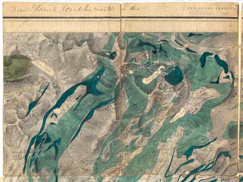
De la Beche preserved his field maps (cut up into slips) as a record of his actual observations. The BGS now holds more than three million fossil specimens, about half a million rock samples (excluding borehole material), and 68 512 registered field slips (excluding Old Series one-inch slips, example below right, which are currently unregistered).
Application of colour to geological maps
The colours chosen to depict rock formations usually attempted to match the overall colour of the rocks themselves, as exemplified by William Smith's celebrated geological map of England and Wales (1815), and the Geological Society's own version compiled by G. B. Greenough (1819) — the latter being the starting point for De la Beche's first colour scheme.
As more formations were recognised it became necessary to employ a wider range of colours or to combine them with ornament.
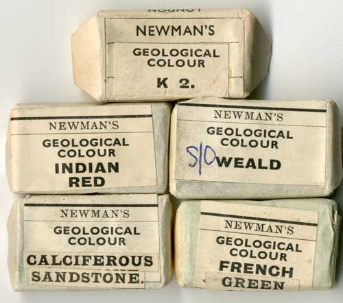
The colours themselves were based on watercolour pigments available from art dealers, but in due course a need arose for the Survey to negotiate the production of specially formulated pigments.
Why the constant need for revision?
Given the rapid pace at which the Government of the day expected the Geological Survey to proceed, and the cartographic limitations imposed by the one-inch scale, De la Beche soon came to recognise the provisional nature of the geological mapping being conducted at that time.
In addition, the significance of superficial deposits was not recognised until the Survey had reached the northern Welsh Borders and East Anglia, where glacial deposits thickly blanket the bedrock geology.
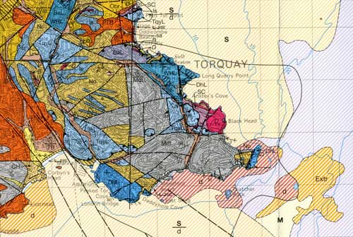
The introduction of topographical maps at the six-inch scale in the mid-nineteenth century created a need, and fulfilled a desire, for more detailed geological information.
This process of adding greater detail and refinement has continued up to recent times, with each resurvey adding greater understanding to what is essentially an interpretation based on the best available evidence.
Mapping in the 21st century
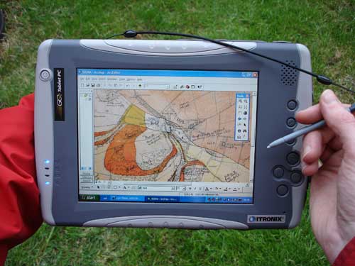
Since 2007 BGS has dispensed with the use of paper field slips and now gathers field data utilising a tablet PC.
The BGS offers free access to geological map data via iGeology, a free smartphone App. iGeology allows the user to access a geological map of the UK by browsing the map or by entering a place name or postcode.

- Tyrannosaurus rex mapped out in East Midlands! Blog by Bob McIntosh
- Irish historical geological maps